Wednesday, December 15, 2010

Sam's Science Chat

Sorry everybody that I haven't writen any thing for a long time but i found something that i think is pretty cool info. Well I live in Oregon with my dad and I know a lot of people who are so prde because we have the deepest lake in the U.S.A in Oregon. So I wrote on this thing for school:

So you all know that Crater Lake is the deepest lake in the U.S.A but do you know what the deepest lake in North America or the deepest lake in the world is? Well I can tell you. The deepest lake in North America is the Crater Lake.
Sorry, but you are wrong. The deepest lake in North America has always been Great Slave Lake in the Northwest Territories, Canada. Why do some people have a difficulty in acknowledging the fact that this title belongs to Great Slave Lake? Crater Lake will always be the runner up for the title.
The deepest lake in the world is...
Lake Baikal (Baikal) in Siberia, Russia is the deepest lake in the world measuring 1620m deep at its deepest point. This makes it not only deep but also the oldest lake in the world estimated to be around 25 million years old.

Friday, November 12, 2010

Fall Field Trip II - Ukiah to Heppner

Once we reached the Ukiah turn-off, we headed west towards Heppner on US Forest Road 53 on the Blue Mt. Scenic Highway. This stretch of road goes over the Blue Mt. Anticline, and a paper by Edwin Shorey  (1976, Geology of Part of Morrow County, Northeast Oregon, Masters Degree Thesis, Oregon State University) suggested that you could map the outcrops over the anticline showing the progression to older units and then back again.

I had been a little worried about this stretch because it is unmaintained in the winter, and it had been drizzling/raining lower down, but the sun came out and it was mostly a nice drive with just a little snow on the road at the summit.

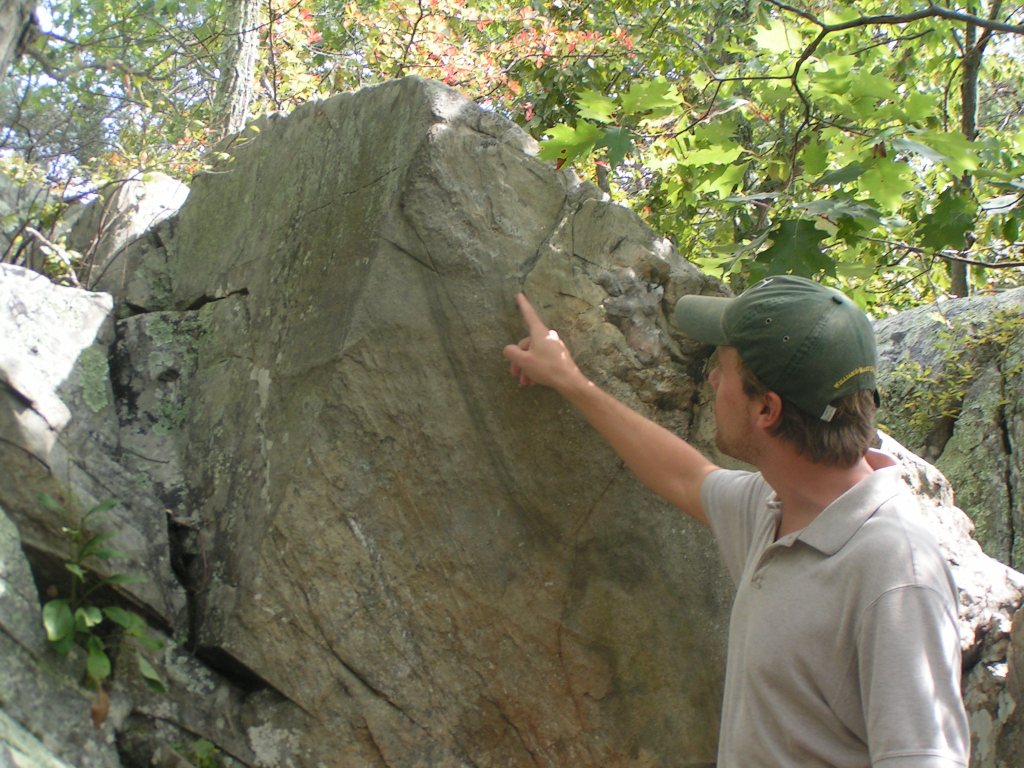
Our first stop was a Pillow Basalt oucropping that Stan had told me about. When I had driven the road before, I went right past it, but this time (knowing it was about 3 miles up the road) we saw it. Nicely formed pillows beneath a more typical CRB columnar basalt
 

Most of the pillows were about 50cm in diameter and well formed, with 2-3 pillow layers reaching a total height of about 2meter. The whole exposure was only about 100m long, with the good pillows being confined to about 20m.  

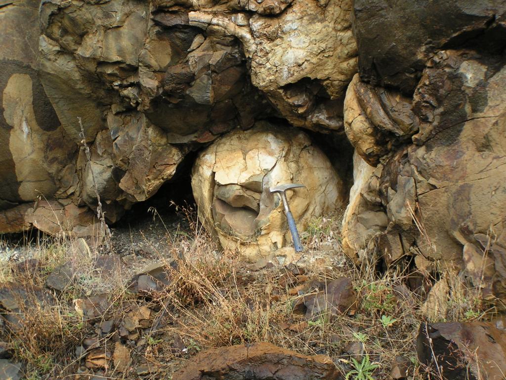
 After the pillow basalts, we continued up over the road for about 8 miles. By and large, there were no rock outcrops or road cuts through this area, and what there was consisted of broken basalts. We stoped at a gravel pit hoping for a nice compotent outcrop but while there were no faces in the gravel pit, the road cut on the other side had some intact basalt columns. 

 Mike cleaned the debris off the top of one of the column so that we could see the hexagonal shape going back into the outcrop.


As we proceded on towards the axis of the anticline we came into the Herren Formation. The Herren Formation is interpreted on Birch Creek as being Fluvial sequences of arkose, mudstone, and shale with Leaf Fossils that indicate an early Eocene age. The Herren Formation also has localized coal seams that give the area its name "Coalmine Hill". We spent some time looking for leaf fossils but did not find any.

At the bottom of Coalmine hill, there is an outcropping of late Jurassic aged tonalite that is similar in age to the granite we saw on Battle Mountain. Although outcrops looked similar, the tonalite outcropping was more competent than the granite, and there were large (5mm) biotite crystals in the tonalite.

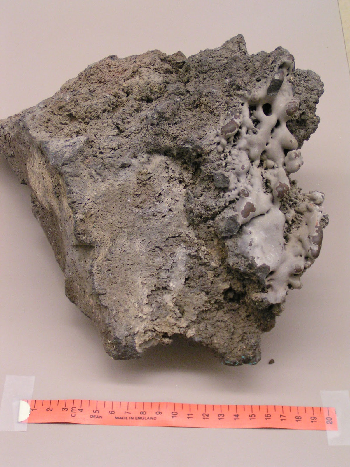
 Also intruded into the tonalite were veins of a powdery fine grained mafic material. There was evidence of contact metamorphism along the edges of these veins, but what was interesting to me was that the core of the vein had a powdery texture. I think what we were seeing is evidence of Tertiary intrusions, but why they are no competent veins I guess I do not know.
On our down Willow Creek, we ran back into the Herron Formation on the other side of the anticline axis. Here, different beds of sand could be visibly seen and were dipping strongly back towards the axis of the anticline. Overlying the Herron Formatio was a nonconforming contact of river cobbles and gravels. We spent some time practicing with our Bruntons and then moved on, but this was an outcrop I'd like to spend more time looking at.

Our last stop was back in the CRB's looking at columns again. These colums were smaller, but not vertical. At this location we saw columns oriented in all directions with some dipping as much as 50 degrees.
 Also at out last stop we noticed this little guy.I was pretty surprised to see him out on such a cool day in Late October, but there was a little sun that he was enjoying.


Thursday, November 11, 2010

Fall Field Trip Part I - Pendleton to Ukiah

Last week I took two students on a drive to look at some of the rock outcrops in the area. I often complain that all you ever see around the area are Columbia River Basalts, but we did find some other outcrops too. Our first stop was a whole 1/4 mile from the college parking lot, at the bottom of the hill. From there we got a close up look at the ubiquitous CRBs in the area. The three layers seen in this photo are accross the river valley from the same (but better) formation I posted about in September.


The top layer, characterized by the grayer more blocky rock is the Frenchman Springs member of the  Wanapum flow. The broad reddish band in the middle is the Vantage soil horizon, on the edges of the horizon there are some baked contacts where the clayey soils have been baked into a marble. At the bottom, looking more like a talus field in this image is the Sentinel Bluffs Member of the Grande Ronde Flow.

In class we have been talking about weathering and sediment transport in class so our next stop was at some Late Miocene deposits in the McKay formation. The alluvial beds are mostly sand, gravel, and cobble, but on some of the north facing slopes there is also Pleistocene Loess.


While poking around, one of the students noticed some mechanical weathering on one of the cobbles, so we could nicely compare the differences between material that had freshly weathered and materiails that had been rounded through transportation. 


The next stop on our field trip was a road cut through Cretaceous aged intrusive outcrop of granodiorite just north of Battle Mt. State Park. The outcrop is heavily weathered with a 5m pile of scree at the bottom, and a nonconformity with the Miocene Grand Ronde Basalts above it.


From the road, the cliff looks real nice, but when you get up close to the rock you notice it is full of quartz veins and really crumbly. We investigated whether it was just excessive surface weathering by digging in 10-15cm with the rock hammer, but it still came out crumbling in our hands. Because the formation is near some thermal springs, we posited that much of the rotten nature of the rock was due to historical contact with some of these thermal features.
Eddie Looking at the quartz veins, note a small bird hole just above his hand
Most of the quartz veins were fairly competent, but there were some that had almost pure quartz powder. This vein was fillled with quartz grains that had the size and texture of white flour.


After Battle Mountain we continued on 395 to  Ukiah and the second part of the Field Trip was over the Blue Mountain Scenic Highway from Ukiah to Heppner.

Monday, October 25, 2010

Lavacicles

The theme fo this month's accretionary wedge is Desk-crops. My favorite deskcrop is one I inherited when I took over my current classroom lab. Because I inherited it, I don't know much of its history although I will assume it was collected somewhat locally. Although it is one of my favorites now, I'll admit that for the first couple of months, I didn't really look at it;  I thought it was another piece of basalt. Sure it had a nice blocky texture and vesicles, but in all, I just considered it another piece of basalt, like the kind we find all over around here.

But then, the former lab instructor started telling me about some of her favorite rock samples in the lab. She mentioned one with "lavacicles," so I got to looking for it, turned over this sample and there they were.

If you look at the right side of the block you can see the texture is much smoother, and the rock forms nice rounded surfaces, like drips frozen in time. I interpret this as once having been at or near the top of an old lava tube, the heat from a subsequent flow was sufficient to remelt a portion of the surface forming the lavacicles.

Saturday, October 23, 2010

Sam's Science Chat

This week in science class we talked about physical changes and chemical changes. One of the chemical changes was we put this alcohol on the desk and lit the desk on fire, the change was liquid to flame, heat, and light. We did this experiment three times the first time we only put a little bit on the desk, the second time we put some more, and the third time we put it all over the desk. The next day we had an assembly, it was the OMSI ( Oregon Museum of Science Industries) one of the things they did was show us what happened to the Hindenburg and he made "elephant toothpaste". On friday we saw a video of this guy with a big tub of murcury and he was talking about how dense it was so he showed us by dropping a cannonball in it to show that it floats.http://www.youtube.com/watch?v=Rm5D47nG9k4

Monday, October 18, 2010

Sam's Science Chat

Sorry I'm late this week I went to my best friends house for the weekend. This week in science we studied matter, and that the two laws of matter are you can not create matter nor destroy matter. with those two laws Mr. S showed us a "magic trick" he put the stuff that is in diapers in a cup ( I am sorry I don't remember the scientific term for it ) and then put water in the same cup. Next he moved them around and made us guess what cup the water was in, but when he flipped the cup upside down nothing came out. Then he had us hypothesize what happend to the water one kid in my class suggested he was a witch. When he told us what he did he showed us how fast it turns a liquid to a solid.

Thursday, October 14, 2010

Earth Science Week

This year's theme for Earth Science Week is "Exploring Energy"

In thinking about Earth Science Week, I tried to come up with a way to tie theme for the week to my role as an educator. Two articles from the popular press caught my attention. First was an article in NEWSWEEK that mentioned flows in the trans-Alaskan Oil Pipeline are down to less than 700,000 gallons (I think they mean barrels) a day out of a capacity of 2,000,000 barrels per day, and that future production was projected to decrease even further.

This article suggests to me the importance of people understanding the economics of oil. It is surprisingly easy to believe that as technologies increase we will simply be able to maintain our level of oil supply. This was reinforced by another column in NEWSWEEK that points out we have been expecting "peak oil" for nearly a century, but that technology advances have allowed us to continue to bring on line more and more resources. However, the second article also mentions that the cost of extracting these new resources is increasing. I think it is vitally important to get the general population to understand that an economy based on fossil based fuels is only going to become more expensive, and  this poses one of the great challenges to our future.

Philip

Wednesday, October 13, 2010

Fossil Day

Today is national fossil day, so I thought I'd share a fossil from my teaching collection and let Sam tell a story about it.

One day in the fifth grade, my dad came to talk about fossils. After showing us a number of fossils, he passed this one around but he didn't tell the class what it was, so they had to guess.

While my dad was talking, one of my classmates K, was examining it very carefully holding it close to her face and smelling it. The boy next to her said "give it to me before you lick it." Pretty soon another girl in the class said she though she knew what it was, she said it looked like Dog Poo so she thought it was fossilized poo. When my dad said that is what it was K got out her 3 oz GermX bottle and dumbed it all out on her hand and began to rub it all over her face and hands.

-Sam

The fun thing for me as an educator was that it definitely created a memorable moment for the class. At the end of the year the students in Sam's class each wrote what their most memorable moment of the 5th grade. Two of the students wrote that they remembered the day that K almost ate dinosaur poo!

Saturday, October 9, 2010

Sam's Science Chat

This week in science, Mr. S let us watch a Planet Earth video and we saw a part were the vine grew in fast mode.

We also saw a video called Toilets in Space. there was an astronaut who was talking about how instead of rely on gravity but air to take away the waist. We watched that video because the interesting science fact of the day was "Astronauts can not belch in space because there is no gravity to separate liquid from gas in their stomachs."

Sam

Friday, October 1, 2010

Sam's Science Chat

This is my first blogging about my science class in school. I will try every week to blog about something that happened in science class, but I have soccer almost every day after school so might not have time with practice and the games. I will call it Sam’s Science Chat.

My science teacher is Mr. S. Mr. S showed us an unborn baby deer this week. It was lying in a jar and had no fur.

Also, every day we get an interesting science fact, my favorites this week were that a giraffe only sleeps 30 minutes a day, they also have seven vertebra in its neck, the same as a human.

- Sam

Sunday, September 26, 2010

Devils Tower


My Dad asked me to write what my most interesting experience in geology was. It was when we stilled lived in Montana, we went to Devils Tower. I thought of it as a big rock that was not a mountain. I liked camping there and waking up to see the sunrise. We took a walk around the base and we saw a huge Pine Snake!
Sam


Thursday, September 23, 2010

What I see on the way home from work

So every day coming home from work, I see this outcropping on the side of the interstate.

In the big picture it is a fairly typical outcrop of Columbia River Basalts that are ubiqitous in our area, but there is more to the story. There are really two layers of Basalts here separated by a layer of baked paleosoils.


What is interesting about this picture is it represents the horizon between two separate flows. The upper layer represents the Frenchman Springs Basalt, the lower member of the Wanapum Flow. The Wanapum flow originated from dikes between Pendleton and Kennewick, WA about 15.3Ma and covered.

In between the two basalt flows, there is a baked layer of paleosoils 0.5-1.0 m thick. This red layer is the Vantage Soil Horizon and represents soils weathered in 200,000 years between flood basalts.

The older  (lower) Grande Ronde Flow originated NE Oregon ending about 15.5 Ma.  The Grande Ronde flow was the most extensive of the CRBs with as many as 18 individual flows covering up to 160,000 km2 with at basalts. Sentinel Bluffs layers are generally only 10-30m thick, but some of the lower Grande Ronde flows were over 80m thick.

Figure Taken From http://geology.isu.edu/Digital_Geology_Idaho/Module10/mod10.htm

This particular member of the Grande Ronde Flow originated from the Chief Joseph Dike Swarm, a series of dikes about 100 miles NE of this outcrop. This is interesting in the fact that today, these dikes are separated from this outcrop by the broad anticline which makes the core of the Blue Mountains

.

Wednesday, September 22, 2010

Washington DC

Last week was THE RODEO in our town, as the kids had a week off of school so had decided to go somewhere else. So somewhere back in the spring we decided to go out to Washington DC to see family, see the sights. One of the things I wanted to make sure and do was get outo and see the Billy Goat Trail, which Callan from Mountain Beltway is constantly blogging about. We were even lucky enough that Callan took a break from field sampling to come up and give us a guided tour.

Even the non-geologists in our group really appreciated having such an exellent guide explaining the geology of the area. As much as enjoy the fact that Sam likes doing all this geologizing with me, I think her true scientific future lies in herpetology, as she spent most of the hike looking for frogs. Here she is looking for frogs in one of the potholes.

and later on Callan pointed out a lizard, which she quickly caught.


 We ended the hike at the Great Falls of the Potomac, which due to the water levels being low were mostly rock.

In addition to the BGT, we went to a number of monuments and museums. One of the museums we visited was the Smithsonian's Museum of Natural History.

On our hike of the BGT, Stanton had asked Callan a question about the shining (mica) minerals in the rock. The conversation led to shiny things and the Hope diamond, which is on display at the Smithsonian
Callan remarked that in the room with the Hope Diamond, he was actually more impressed with the big piece of copper that everyone ignores. Stephanie sort of snickered and assured me that she would be looking at the diamond, but when we got to that room, even she agreed that the piece of Native Copper from the White Pine Mine (Michigan's Upper Peninsula) was really quite impressive.


I actually liked the nice piece of gneiss,


but everyone did agree that the Hope Diamond may not have been the highlight of the room.

Philip

Saturday, August 28, 2010

Switzerland

I went to Switzerland to visit my Uncle and his family. While I was there we saw castles, mountains, and the Rhein Falls. Here are some pictures from my trip.

After we hiked up a mountain to have lunch, Grandpa and I rode down the mountain on these scooters!

This is a cow that I encounter on one of the mountains. So I got close enough that I was able to pet it, but before I got to pet it, the cow licked my hand and its tounge felt really weird!


This is a picture of a mountain with a lake in front of it. My Dad says that there is some cool geology of folding rock layers that can be seen


When we were hiking up a mountain to go down in a cable car we saw this sign which in Swiss German says "Kids must be on Leash" because it is steep. I though it was a good laugh.
This is the Matterhorn behind me. It was really cloudy that day so the most we saw was 2/3 of it.


Sam


Thursday, August 19, 2010

Sawtooth Crater

So Sam has been travelling over in Europe, and Stanton and I have been in the midwest. Hopefully we will put some posts up from that later. But yesterday, Sam was in La Grande for an orthodontist appointment (braces are in her near future), so I thought we'd take advantage of being in the Grande Ronde valley and try a hike, one I thought might be interetsing for a future field trip.

In the end, I probably would not take a class because it was a long drive (about 30 miles SE of Union or 20 miles NE of Baker) , a short hike, and limited geology, but it was neat.  Sawtooth Crater is the remnant of a Miocene aged shield volcano. The main feature is a central spire that raises about 420feet above the crater floor and two prominant radial dikes that extend to the NE and SW.

My picture of the central cone is not very good, I took it from where the trail comes up to the NE radial dike


From that point, instead of going up to the central cone, we went NE towards the rim. From there we had some good views of the steeply dipping platy andesite that makes up the dikes. Here is a 1.45m Stanton in front of the ridge.


And here is a view of the same section of the dike from the crater rim, about 500m away.


Along the top of the dike, the andesite formed thin, steeply dipping layers that are very angular (sharp) along the ridgeline


Although I did not see any evidence of tuff, in a couple of places along the rim, I found pycroclastice bombs


In all a neat little hike, but the long drive for a short hike. We had hoped to do another hike in the area, but it was getting late so we headed home

Thursday, July 8, 2010

Solar Panels

After much delay trying to get financing, fighting with the bank (and losing) over refinancing our mortage, waiting for the equipment, and last minute permitting, today we are having our solar panels installed. Contractors started yesterday putting the racks on the roof and then today got here early, about 6:30 am as I was returning from taking Sam to morning swim practice, to beat the heat. Once they are in we will still have to wait days (hopefully not weeks) to get everything inspected and to flip the switch, but I have been waiting since April just to get the panels on.


In the end we opted for 10-235 watt panels which according to our solar area should supply around 2400 kwH/year (about 40% of our annual use). Thanks to Uncle Sam and a bunch of other incentives our final cost will be right around $2000. Now lets just get them turned on to take advantage of these long sunny summer days.

Friday, June 18, 2010

Cub Scouts

So I spent today talking to Cub Scouts about Geology. It was a pretty simple presentation, we talked about what geology was, why we would study it and then I introduced the three types of rocks. It was obvious some had worked on their geology section before as they would know igneous, sedimentary, and metamorphic, but most did not. So I took them through a basic rock cycle and how each type of rock is formed and then passed out hand samples and had them try and identify which rock type is was. It was a lot of fun for me.

It always amazes me how much kids like rocks, asking questions and just learning in general. The scoutswere very engaged with the activity and many of these 8-10 year olds were asking better questions than my college students. Its not that I think the college students can't ask good questions its just that so many just do not care. I understand that most of my college students aren't going to be geologists , but so many of them also have a level of detachment. It was so different to work with the scouts who were just excited to learn. It also makes me wonder where (and why) do kids loose that aptitude for learning, and what (if anything) can be done about it.

Thursday, June 17, 2010

Top 10 Parks

I'll Play Lockwoods game, where he posted the 10 most visited and 10 least visited National Parks, bolding the ones you've visited and italicizing the ones you've never heard of.  Sam's at morning swim practice (in the rain) so I'll add the ones that she's been to in parenthesis:

Most visited:


10: Glacier
9: Acadia
8: Grand Teton (Sam was here when she was <1 year)
7: Cuyahoga Valley
6: Rocky Mountain
5: Olympic
4: Yellowstone (Sam was here @ age 8)
3: Yosemite 
2: Grand Canyon (When I lived in SLC, I set out to go here at least 7 times, each time I got distracted by one  of the other parks/wilderness areas in southern Utah)
1: Great Smokey Mountains (I do not remember if I have been here or not, if it was it was when I little)

Least Visited:
10: City of Rocks NR, Idaho (I drive by this all the time on trips to SLC, keep meaning to stop and climb...)
9: Cumberland Island NS, Georgia
8: Florissant Fossil Beds NM, Colorado
7: Chiricahua NM, Arizona
6: Tonto NM, Arizona
5: Dry Tortugas NP, Florida
4: Katmai NP & Preserve, Alaska
3: Kalaupapa NHP, Hawaii
2: Hagerman Fossil Beds NM, Idaho
1: Russel Cave NM, Alabama

Wednesday, June 2, 2010

Multnomah Falls

One of our other excursions over Memorial Day Weekend was to Multnomah Falls. This stop was largely  influenced by my talking about how basalt fractures when it cools. When basalt cools slowly it will create vertical fractures in hexagonal or pentagonal shapes, and usually when I talk about it I show this picture taken of Sam and Devils Tower National Monument a few years back


But thisi year I was looking for something more local and that showed the fracture pattern a little more clearly, so I showed this image that I took last year (on our way back from a camping trip at Magone Lake) of a road cut on the Middle Fork of the John Day River. Here is a view of the base of the pillars


And here is a view of the pillars themselves, with Sam for scale.


Because this location is off the beaten path, so I tried to think of another example in the myriad of Basalts around town when one of the student said, "You mean like at Multnomah Falls?" To which my only response was, "I don't know, I haven't been there yet."  This caused no end of chiding from my students, so when the opportunity came  up this weekend of course, I went. And sure enough up near the top are nicely fractured Basalts.


The exposure at Multnomah also has pillow basalts, and a big section missing from a mass wasting event that occured in 1996 when a block the size of a bus fell creating a wave that injured 12 people.
  

The areas of interest, especially the columnar basalts were still way up high and hard to see, even harder to get a decent photo especially with the spray from the falls. So in the end my students were right, and they got me to visit Multnomah falls, but I am still looking for a more accesible image to show my students.

One final thought about Multnomah, it is the quintessential American tourist stop. Breathtaking scenery right off the interstate (actually, you do not even need to get off). The only draw back is that from the interstate there is about a 200 yard walk (under the eastbound lane) to get to the viewing area. Maybe it was because it was Memorial Day Weekend, maybe it was because it was Saturday, maybe it is always that busy, but whatever the case I feel no need to go see it again.

Philip

Monday, May 31, 2010

Memorial Day Weekend in the Columbia River Gorge

So Sam had a series of softball games in Hood River on Saturday. I was excited about this because this was an opportunity for me to get into the Columbia River Gorge. Despite being in Oregon for almost 2-years, I had only been in the Gorge once on a return trip from Ape Cave on the southside of Mt. St. Helens. And on that trip it was dark and I was the only driver so I did not get to see much geology.

On this trip, either because she was more awake or because she knew I would be looking at rocks, Stephanie drove down to Hood River, so I got to gawk. I tried taking pictures from the car, but most did not turn out, but I did get one that showed the "cake layers" of the individual flows. This picture was taken at about mile marker 79 and shows the Washington side of the Columbia River. Unfortunately when I got the shot there were no cars (or better yet trains) on the other side for scale.


On the way home, I got this shot from the Columbia River Gorge Discovery Center Museum in the Dalles (exit 82). It does not have the same nice layers as the previous image, but it does show the layers dipping towards the river (SE) and it has a BNFS train for scale.


Oh  yeah, the softball game....  Won one, lost two (both by 1 run), Sam went 1 for 6 with her one hit being a nice line drive into center field. She made it to third when they missed the throw and tag at second, but in the end was left on base.

Philip