Showing posts with label Hiking. Show all posts

Sunday, January 15, 2012

More Summer Trips

Ok, so its been a while since I have been able to sit down finish posting about our trips last summer. After our trip to Sumpter/John Day, we spent a week at the coast. Most of our time at the coast was spent playing in tide pools and seeing non-geology things, but I did take one picture of some barchan dunes on the beach below the Yaquina Bay Lighthouse.


On the trip back to the east side of the state, we took the scenic detour through the desert high plains. This allowed us a stop at Crater Lake, which Sam had been wanting to go see ever since we moved to Oregon.

Stanton at the Rim near the North Entrance
We got to the park about 1 hour to late to take the boat ride (next time Sam) so we did the obligatory drive around the lake. Sam's favorite stops was at Pinnacles, where the steam from fumaroles welded together the overlying pumice and ash into an erosion resistant hoodoo.

On the way back from Pinnacles, we stopped at the new trail in the park, a 2.5 mile out and back to Plaikni Falls. It was a nice little trail through the woods, and the falls at the end were a nice surprise (ok I knew there was a waterfall, but it was more impressive that I had anticipated). Sam, however was tired, so by the time we got to the falls she had transformed into a bit of a sullen teenager.

Plaikni Falls

I think overall, Sam was a little disappointed in the lake. (I found out later that, being who she is, what she really had wanted to do was go swimming in the Lake. She didn't expect only one access to the lake that was 2-3 miles down a steep trail to a non-existent beach that would have been hypothermia inducing cold at that rate!)

Friday, October 14, 2011

Mt Baker cont

In previous posts, I wrote about our Rodeo Holliday trip that ended with a day at Heather Meadows on the side of Mt. Baker. The last notable thing about the trip was we had a great conversation about how science is supposed to work. At an earlier stop, I had pointed out the sun cups on top of the snow field, and mentioned that the how and why suncups form is a question that hasn't been completely answered. While exploring a snowbank Sam noted that there were suncup like features under the snowbank as well.


As we walked down the trail we made theories about how the suncup features would form on the bottom of a snowbank, and if the theories were testable. My theory was that it was based on the crystal structure of ice, but when pressed by Sam how I would test it, I did not have much of an answer. Her theory was the rocks under the snowbank (in the streams) initially forced the meltwater up over the rock creating the curved shape. Her test was to se if there was a correlation between cup location and size and an underlying rock.

At the next snowbank she ducked under to test her hypothesis

and sure enough there was a rough correlation between boulder location/size and suncup size. She repeated her observations at the next (last) snowfield we encountered and her subjective test held true. In the end she felt pretty proud she had come up with a theory that made more sense (to her) than her dad's and she was able to prove to him that she was right!

Wednesday, October 12, 2011

Mt Baker

In my previous post, I mentioned that on a Rodeo Holiday we went up to Heather Meadows on the Mt. Baker Highway. While we were there, we ran into a High School Geology class and the instructor pointed out to me that even though we couldn't see any mountains, there was some notable geology under foot.

Basically the canyon that forms drains Bagley Lake is a fault. On the west side of the lake is the Chilliwack River Terrane an accreted island arc, and on the east side are Mt. Baker Andesites. The Bagley Lakes trail parallels this drainage and crosses over a small dam, where you can see the difference in rocks from one side to the other.

Sam Looking at Mt. Baker Andesites

Sam Looking at Chilliwack Terrrane
  According to the USGS website on the Chilliwack Terrain, it is mostly phyllites and Greenstones that are thrust over the younger Nooksack Terrane.

Before the Chilliwack River terrane was thrust over the Nooksack terrane, its beds were folded upside down.
From: Terranes of the North Cascades: Chilliwack River Terrane
We saw a couple of nice metamorphic rocks on our hike. Admittedly the weather wasn't conducive to finding the best examples (and I am not great at identifying metamorphic rocks), but there were three areas that had distinctly different outcrops

Greenstone with quarts veins
 
Metaconglomerate
 
Not sure with this one, originally thought it was a different metaconglomerate, but then thought about a fault Breccia, didn't know if that made sense. Help?
Though I certainly saw the difference between the rocks, I was in "Look at the Mountain and Glacial Features mode" so I'm not sure if I would have put together the drainage was a contact between terranes. So thank you to the unnamed HS teacher I met. It certainly made more sense to look at rocks than mountains on that foggy day.

Tuesday, October 11, 2011

Return of Fall

I am taking my Physical Geology students on a field trip today so I turned on the weather channel to see what the weather was going to be like. A screenshot from their website shows the weather forecast for our area.


A bit of good news for me! As we are headed for that little gap in the rain shown by the arrow!

 But another section of the map caught my eye, that light blue swatch of snow along the Washington/Canada border. This is the area around Mt. Baker Ski area, and when Sam, Stanton, and I took a trip up there during our Rodeo Holiday in mid-September spring had just arrived.

It had been a gorgeous warm fall, and on the beginning of the Rodeo Holiday trip we had taken advantage of weather and went to the San Juan Islands.

 Because the weather was nice, and we were about as close as we would ever be, I thought we'd extend our trip a day and go up the Mt. Baker Highway. Mt. Shuksan is one of those oft photographed Mountains, and I wanted to see it for myself. However, by the time we got to Heather Meadows Visitor Center, this was the view that greeted us.

We had actually intended to go all the way to Artist point, but the road to Artist Point did not open this year because the snow never melted. There were record snowfalls (over 900 inches) and when they went to plow the road in July there was still over 50 feet of snow over portions of the road. With all that snow, summer never really arrived. We saw one willow bush that was still in bud.

Because of the snow we went on two short hikes near the visitor center. One, The Fire and Ice trail, which has placards which presumably highlight geologic features of glaciers and volcanoes, only the placards had not been put in yet for the season. We did see lots of neat basalt columns.

  
The columns were tilted in many places 
  
so you could see the tops too. 


and a nice cirque/tarn at the end far of the trail.


Despite the lack of view and winter like weather, I had a good time looking at the rocks. In fact a HS geology class was up there at the same time we were, and the instructor told me about some geology to look for which I'll summarize in a future post. 


Tuesday, April 12, 2011

Arches

For Spring Break I went to Utah, but I didn't just go anywhere, I went to Arches National Park for two nights and Goblin State Park for one night.

At Arches, we went on three hikes. The first hike was to Devil's Garden where we we saw several arches. One of the first two arches was called Tunnel Arch, but we didn't get a picture of that one. The second was Pine Tree Arch. We took a picture that made it look like I was holding it up, but acutally the arches was three or four times my height.

After Pine Tree Arch, we went to another part of Devil's Garden where we saw three Arches. The first was called Landscape Arch, it is the biggest Arch in the World! On the trail there was a sign that talked about a day when a piece of the arch fell and someone got a picture of it!


Then my Dad and I hiked up to Partition Arch and Navajo Arch. From Partition Arch you could look through a window to Landscape arch, but my favorite arch was Navajo.


On the way to Navajo Arch there were some wind pockets in the wall that you could hide in


Thursday, January 20, 2011

Oregon Coast

After Stanton's concert on Saturday, we headed for the Oregon Coast and drove north from Florence to Lincoln City. It was warm, but very windy and raining hard so we did not make as many stops as I wanted, but I guess that gives us reason to go back.
Hecata Head Lighthouse

Our one long stop was at the Cape Perpetua area. Even though it was low tide, the wind was blowing the waves into the basalt nooks putting on a very good show of spouts and sprays. Sam went exploring tide pools while I tried to get pictures of sprays and rocks. It was interesting walking on the basalt because despite all of the rain and wind, the traction was very good. It was also interesting to see the basalt fracturing into fins that ran mostly perpendicular to the coast. Because of the rain I really didn't get any good pictures other than this one of Thor's Well

Thor's Well
We had a lot of fun, but it was wild weather. I haven't been in rain/wind like that since I was on othe Juneau Icefields in 1991. After about 20 minutes we were soaked to the bone, but we had fun!


Wednesday, September 22, 2010

Washington DC

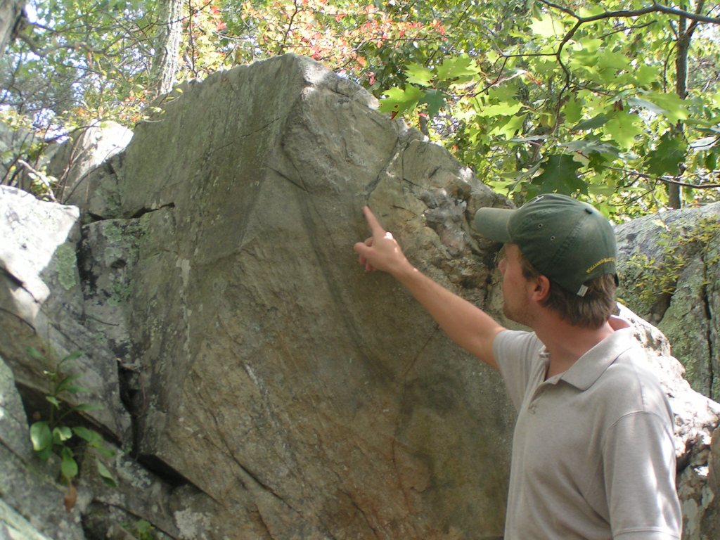
Last week was THE RODEO in our town, as the kids had a week off of school so had decided to go somewhere else. So somewhere back in the spring we decided to go out to Washington DC to see family, see the sights. One of the things I wanted to make sure and do was get outo and see the Billy Goat Trail, which Callan from Mountain Beltway is constantly blogging about. We were even lucky enough that Callan took a break from field sampling to come up and give us a guided tour.

Even the non-geologists in our group really appreciated having such an exellent guide explaining the geology of the area. As much as enjoy the fact that Sam likes doing all this geologizing with me, I think her true scientific future lies in herpetology, as she spent most of the hike looking for frogs. Here she is looking for frogs in one of the potholes.

and later on Callan pointed out a lizard, which she quickly caught.


 We ended the hike at the Great Falls of the Potomac, which due to the water levels being low were mostly rock.

In addition to the BGT, we went to a number of monuments and museums. One of the museums we visited was the Smithsonian's Museum of Natural History.

On our hike of the BGT, Stanton had asked Callan a question about the shining (mica) minerals in the rock. The conversation led to shiny things and the Hope diamond, which is on display at the Smithsonian
Callan remarked that in the room with the Hope Diamond, he was actually more impressed with the big piece of copper that everyone ignores. Stephanie sort of snickered and assured me that she would be looking at the diamond, but when we got to that room, even she agreed that the piece of Native Copper from the White Pine Mine (Michigan's Upper Peninsula) was really quite impressive.


I actually liked the nice piece of gneiss,


but everyone did agree that the Hope Diamond may not have been the highlight of the room.

Philip

Thursday, August 19, 2010

Sawtooth Crater

So Sam has been travelling over in Europe, and Stanton and I have been in the midwest. Hopefully we will put some posts up from that later. But yesterday, Sam was in La Grande for an orthodontist appointment (braces are in her near future), so I thought we'd take advantage of being in the Grande Ronde valley and try a hike, one I thought might be interetsing for a future field trip.

In the end, I probably would not take a class because it was a long drive (about 30 miles SE of Union or 20 miles NE of Baker) , a short hike, and limited geology, but it was neat.  Sawtooth Crater is the remnant of a Miocene aged shield volcano. The main feature is a central spire that raises about 420feet above the crater floor and two prominant radial dikes that extend to the NE and SW.

My picture of the central cone is not very good, I took it from where the trail comes up to the NE radial dike


From that point, instead of going up to the central cone, we went NE towards the rim. From there we had some good views of the steeply dipping platy andesite that makes up the dikes. Here is a 1.45m Stanton in front of the ridge.


And here is a view of the same section of the dike from the crater rim, about 500m away.


Along the top of the dike, the andesite formed thin, steeply dipping layers that are very angular (sharp) along the ridgeline


Although I did not see any evidence of tuff, in a couple of places along the rim, I found pycroclastice bombs


In all a neat little hike, but the long drive for a short hike. We had hoped to do another hike in the area, but it was getting late so we headed home